
Discovering passes
How to find mountain passes around you
Browse every pass in Mountain Passes by distance, filter by country, elevation, road type and surface, read the map colours, and check a pass before you commit to it.
Video guide coming soon. The written steps below cover the same ground.
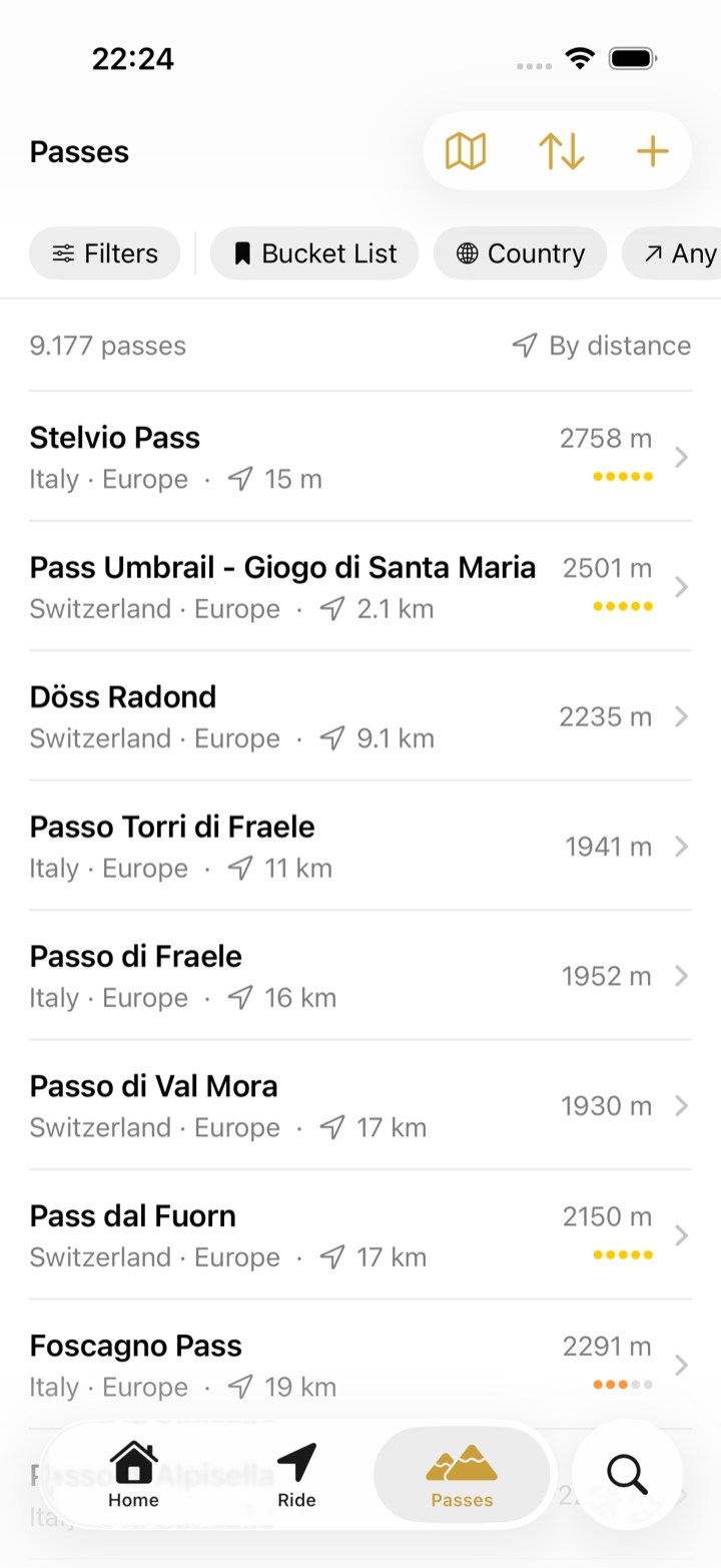
The Passes tab holds the whole catalogue, sorted by distance from where you are, with filters that cut it down to the passes worth a detour today. The map behind it colour-codes every marker so you can tell at a glance what you have crossed, what is waiting, and what is closed. All of this is free.
Before you start
- Free. Browsing, filtering and the map are included.
- Location access lets the list sort By distance; without it, sort by name, region or elevation instead.
Steps: narrow it down
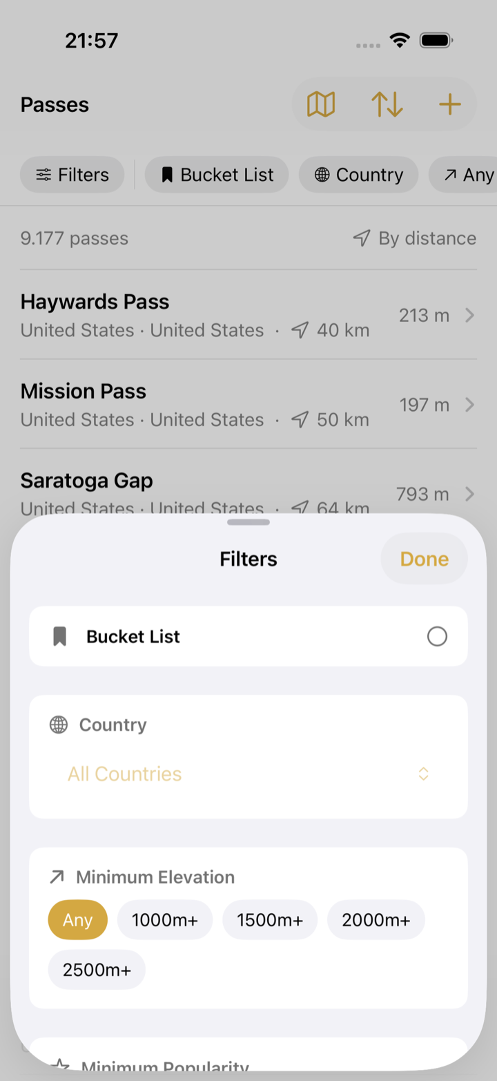
- Open the Passes tab. The chips under the title show the active filters; tap Filters for the full set.
- Pick a Country, a Minimum Elevation (1000 m+ to 2500 m+) and, if you like, a Minimum Popularity (Notable+, Popular+, Famous) to surface the classics.
- Set Road Type (Major Roads, Minor Roads, Tracks Only) and Surface (Paved Only, Unpaved Only). Riders on road tyres want paved; gravel riders want the opposite.
- Under Status choose Unvisited to hide everything already in your collection. Time Period narrows the visited list to one year.
- Tap Sort to order by Distance, Elevation, Popularity, Name or Region. The count above the list tells you how many passes match.
Reading the map
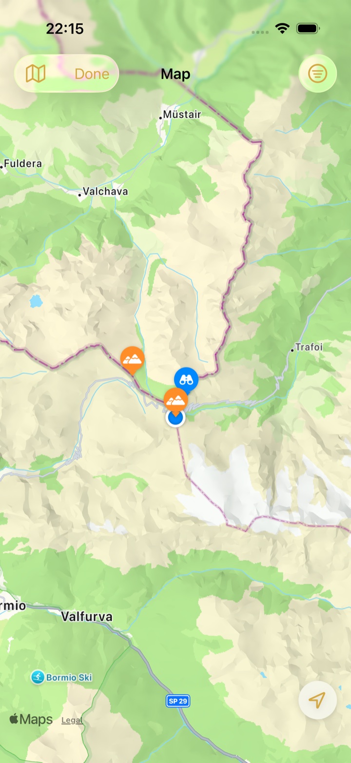
Tap Map in the Passes tab to see the same passes as markers.
| Marker | Meaning |
|---|---|
| Green | Crossed |
| Orange | Not crossed yet |
| Red | Access restricted, according to road data |
| Yellow | On your bucket list |
| Blue number | Several passes; zoom in to split them |
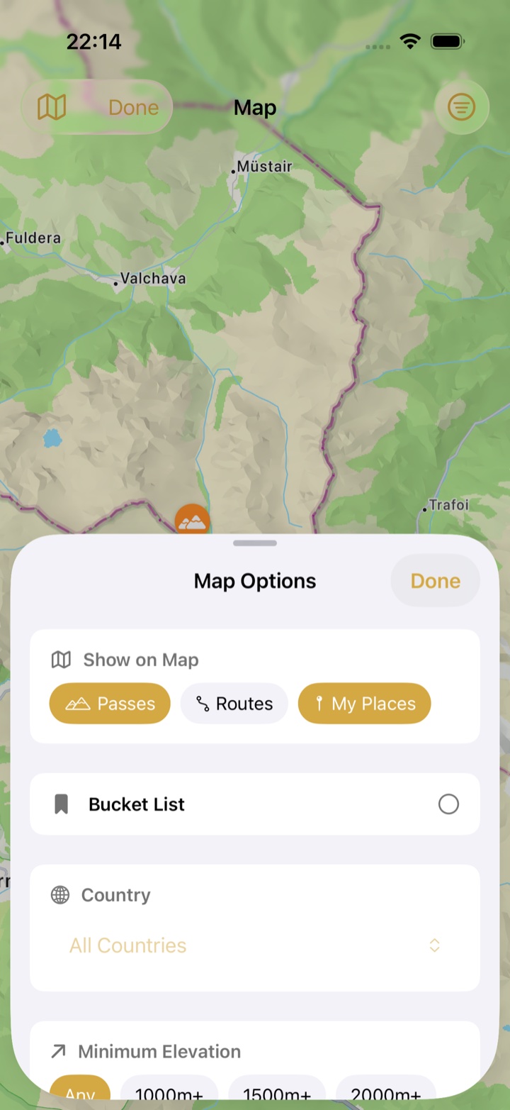
Map Options lets you show or hide Passes, your recorded Routes and My Places, carries the same filters as the list, and jumps to All Passes, Visited or Routes.
Check a pass before you go
Open any pass for its elevation, region and country, the road and surface data, a Wikipedia summary where one exists, and the poster if it has one. Where the road data records a winter closure, a chip such as Closed Nov–Apr sits next to the road type, so you can rule out a pass before planning around it. Two buttons matter on the road: Go opens the pass in Apple Maps for navigation, and Log adds a visit by hand. Pro users also see the driving time from where they are. If other riders have reported closures or restrictions, Access Issues Reported appears with the date of the latest report; for official road status, the pass pages on this site link to the sources for each pass.
Passes on your route
Plan a route in your navigation app, then open the map along it: every orange marker near the line is a candidate. Add the ones you like to your bucket list so they turn yellow, and during the ride Pro shows them in the Nearest Passes list.
Troubleshooting
- The list is empty. A strict combination of filters can hide everything. Tap Filters and reset Country or Status.
- "Location unavailable" instead of distances. Allow location access in iOS Settings › Apps › Mountain Passes › Location.
- A pass is missing. Tap Add in the Passes tab to create it with a name, location and elevation. Leave Suggest for main database on and it is reviewed for the catalogue everyone gets.
- The data on a pass is wrong. Open the pass and choose ⋯ › Report Issue.